 This 1874 map of Niles shows the location of Vallejo's mills and a small cluster of nearby buildings. The Shinn property can be seen bisected by Alameda Creek with William Sim's acreage directly below. Sim and his wife built another house to live in; their original cottage now belonged to the Shinns. The current town of Niles was platted onto the area marked by the finance company, east of Vallejo's Mill and north of Alameda Creek.
Here is William Sim's cottage that Lucy and James Shinn lived in for 20 years before building their large family home. Note the vegetation enfolding the house; for a blacksmith, Sim was really into horticulture! He experimented with a lot of hybridization, especially with fruit. Shinn wrote that Sim was a hard drinker who one day tried to playfully (!) put his wife into a barrel of flour headfirst. Shinn did not say whether or not Mrs. Sim matched her spouse in alcohol consumption or what she thought about the barrel escapade.
 Here is Sim's cottage today in Shinn Historic Park and Arboretum.
Niles has two entrances from Mission Blvd. One is the Sullivan Underpass and this one is the corner of Niles Canyon Rd. where it crosses Mission Blvd. and turns into Niles Blvd. I walked over to Vallejo Mills Historical Park from my home along the creek and then climbed up to Mission Blvd. and crossed to the park.
 Here is the view from Mission Blvd. (the Niles sign is right at my back) towards the park.
 There is a state Historical Landmark sign at Mission Blvd. which I have driven past about eight million times without seeing. After a first visit to the park where I could not find the remains of the mill, I went back along Mission Blvd. to be sure I was at the right place. I was.
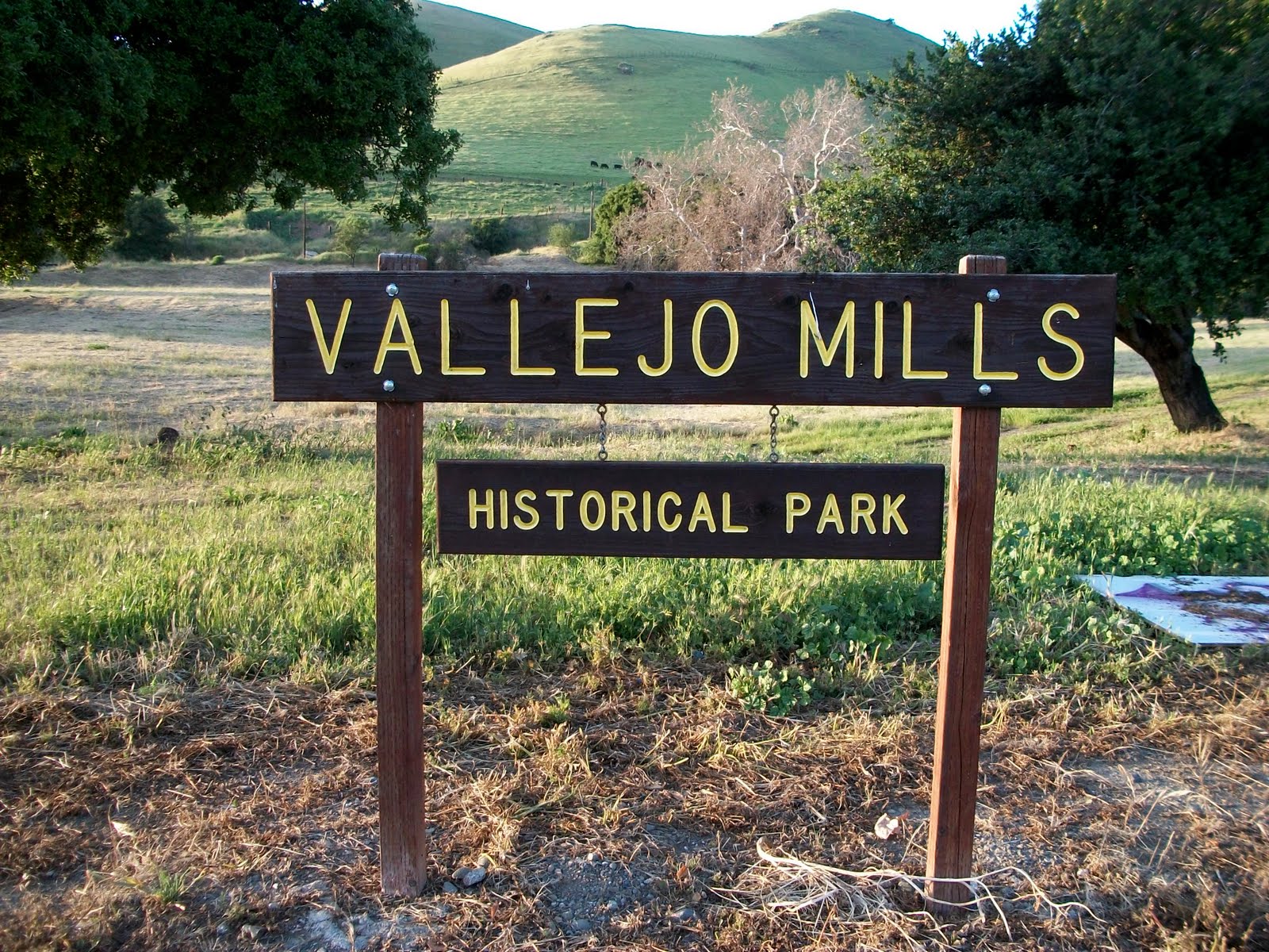 Another sign I've driven past eight million times. At the corner of Mission Blvd. and Niles Canyon Road but facing Mission only. If you are approaching the park from the canyon you have already missed the very low-key entrance.
 Walking up to the foundation of Vallejo's second mill that was completed in 1856.
 One of the exterior walls.
 Looking down into the interior of the mill's ground floor level. The upper two wooden stories are long gone.
 Bailey out in the field with me, exploring the mill interior.
 Looking from the mill back towards the intersection of Mission Blvd. and Niles Canyon Rd.
 More poppies. One of the best parts of spring.
 Just above the mill, the tracks head towards Niles. The tracks are situated on top of an overpass just before the Mission Blvd. and Niles Canyon Rd. intersection.
Facing the opposite direction, these tracks (and Bailey) are headed towards Sunol, six miles away.
 The one small irrigated stretch of lawn in the entire park.
 A poppyless view towards Mission Blvd.
Backtracking towards home, here is a glimpse of Alameda Creek through pepper tree leaves. The Army Corps of Engineers built levees along the creekbed when they put in flood control. The creek seriously flooded Niles several times over the years and caused much damage. These levees are now pedestrian/bike paths that start in Niles Canyon and end 11 miles away at Coyote Hills, right on San Francisco Bay.
 Alameda Creek right where I enter and exit the park at the end of L St.
There are always ducks and geese and other birds I cannot identify in the water.
 Bailey loves living close to the creek where she can legally be off-leash.
In my first blog I promised I would find out why Niles was once called Vallejo Mills, Vallejo’s Mills, and Vallejo’s Mill; I’ve seen it written each way on various old maps. Charles Howard Shinn claimed squatters also called it “Gopher-town,” but cartographers never recorded this sobriquet! Shinn was the son of Lucy and James Shinn, who came to Niles in 1856 when Charles was just two years old. One of the many things Shinn did as an adult was to write a series of newspaper articles about the history of Niles and the surrounding area, all of which he was very familiar with. These 1899 articles are some of the best primary materials I have come across in terms of an eyewitness account of Niles in the latter half of the 19th century. Shinn was interested not just in horticulture but history as well. He wrote articles about many different aspects of the area and managed to connect them, e.g. the use of schooners from East Bay landings to move goods to the San Francisco market before the railroad was built. I am looking forward to reading all of the articles this coming summer when my time will be freed up by being out of school.
The Spanish founded Mission San Jose in 1797, Mexico won its independence from Spain in 1821 and began secularization of the missions in 1834. Don Jose y Jesus Vallejo (nephew to Mariano Vallejo) was appointed administrator to Mission San Jose in 1835. He and his family lived in an adobe house across from the mission. In 1841/42, he was granted 17,705 acres of the former mission lands. J.J. Vallejo promptly built an adobe house to shelter his majordomo and vaqueros (he was running 10,000 head of cattle) and a two-story adobe grist mill, to turn wheat into flour. Hence the name of Vallejo’s Mill. John C. Fremont stopped here in 1846 to commandeer food and supplies for the Bear Flag Revolt. Hence the later name of Fremont being applied to the larger city that would incorporate Niles in 1956.
J.J. Vallejo built a wooden three-story mill next to the original adobe mill in 1856; perhaps the area then became known as Vallejo’s Mills. These two mills were located at the mouth of Niles Canyon from whence Alameda Creek flowed towards the San Francisco Bay, some 11 miles away. (Mission San Jose today is about a ten-minute drive heading south down Mission Blvd. from Niles and the site of Vallejo’s mills.)
Beverly Bastien wrote about the 1851 Land Act and how Californios like J.J. Vallejo had to prove title to their lands. Vallejo definitely suffered from squatters; he was embroiled in 145 lawsuits over the years. Shinn wrote that “no one could get titles to land” in Vallejo Mills when squatters/settlers began to arrive following the 1849 Gold Rush. While Bastien estimated most Californios spent 17 years in litigation, U.S. President James Buchanan approved J.J. Vallejo’s claim in 1858, only seven years after the Land Act was passed. However, he was forced to sell off much of the land for court costs.
In 1853 blacksmith William Sim and a partner, E.P. Flint of Oakland, were squatting along Alameda Creek just a few minute’s walk from the mills; they planted both wheat and various fruit trees. Sim sent an example of his first growth of wheat to the Crystal Palace in London, England for the “World’s Fair” in the summer of 1853; one stalk stood ten feet three inches high with a single head producing 80 grains and the overall 70 heads producing 4200 grains. Needless to say, this fecundity boded well for the area’s agricultural potential. Shinn wrote that wheat was considered the foremost crop during the 1850s and 1860s, with settlers only planting a few fruit trees, “for the idea of ‘money in the orchard’ was slow to take hold.”
Once it did, fruit was ferried by schooner from landings in the East Bay to San Francisco. With the local market saturated, interest in fruit growing waned until the advent of the railroads. With this new capability of transporting goods relatively quickly over much longer distances, horticultural interest in Niles revived and began to flourish anew. More about that later.
In the meantime, J.J. Vallejo’s son, Plutarcho Vallejo, had studied to be a mining engineer at Santa Clara College (today’s Santa Clara University). In 1869, as Leland Stanford was laying railroad track through Niles Canyon to form the final link of the transcontinental railroad, Plutarcho worked with surveyor Luis Castro to subdivide the area around the two mills and the various other dwellings constructed by Vallejo’s workers. The single street was named Vallejo Street (it was a short stretch of the original mission road, later known as the County Road and finally named Mission Blvd.) with the two mills at one end and 23 lots laid out along both sides of the street.
In 1870, the Central Pacific Railroad Co. built a train depot a very short distance northwest from Vallejo Mills and dubbed it the Niles Station, after Central Pacific attorney Addison C. Niles, who later became a California Supreme Court judge based in San Francisco. Those who did not live in the tiny Vallejo Mills subdivision had property along the south bank of Alameda Creek or acreage along today’s Mission Blvd., either north towards Decoto or south towards Mission San Jose. Today’s town of Niles was platted east of Vallejo Mills and north of Alameda Creek at some point during the 1880s. The Southern Pacific Railroad Co. (the Central Pacific was subsumed by the Souther Pacific in 1884) registered the new plat in 1884, with nearby Vallejo Mills now becoming “Old Town.”
The unroofed walls of Vallejo’s mill (supposedly of the second and larger wooden mill, but they look like crumbling adobe to me; surely those wooden walls must have sat on top of this adobe foundation) can be visited today at Vallejo Mills Historical Park, a state landmark. The walls are quite close to busy Mission Blvd., but are obscured by a sound baffle wall. You can only see them by parking in the rather distant lot and approaching them on foot. The now dry creekbed that fed the mill can be seen and the railroad tracks leading out of Niles Canyon over to Niles can be seen a very short distance away. An enormous eucalyptus tree towers nearby with native coast live oaks providing some much-needed shade at the edges along Mission Blvd. The park has one irrigated stretch of lawn nowhere near the mill remains, with the remainder of the area left to grow as it will. I do not know if this park has always been so modest or if it is reflecting the current state of many California parks due to recent budget woes. It is really cool to be able to view and climb around the former mill.
The sources I used for this blog include; 1) Map of Washington Corners, Haywards Park, Niles, Pleasanton, 1878, 2) Shinn, Charles Howard. Historical Sketches of Southern Alameda County (First Published in the Oakland Inquirer as a Series of Articles June 8 – November 18, 1889) Alameda County Historical Society. Oakland: GRT Publishing, 1991, 3) Holmes, Philip and Jill M. Singleton. Niles Fremont. San Francisco: Arcadia Publishing, 2004, 4) Ockerman, Phil (ed). City of Fremont: the First Thirty Years. San Francisco: Mission Peak Heritage Foundation, 1988, and 5) Bastien, Beverly. “’I Heartily Regret That I Ever Touched a Tile in California’: Henry Wager Halleck, the Californios, and the Clash of Legal Cultures,” California History 72:4 (Winter 1993/1994): 310-323.
What a wonderful detailed history of Niles that I stumbled upon. It captivated me and I have linked this blog to http://www.squidoo.com/historic-niles-district-of-fremont-california
ReplyDeleteThanks for sharing this.
I need to go stand by that sign.
ReplyDelete-Niles